01 January 2026
Using GIS in Collaborative Disaster Response – Case of the Francis Scott Key Bridge Collapse
The Infrastructure Show - Podcasts
About
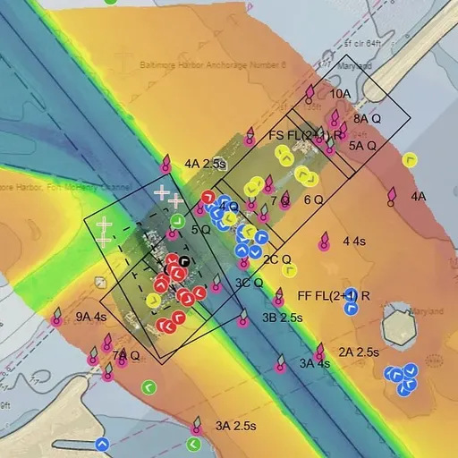
A major role of the U.S. Coast Guard is responding to waterborne disasters. Managing large scale disasters usually calls for multi-agency collaboration based on shared information. In such situations, the Coast Guard relies on Geographic Information Systems (GIS) to provide a common operating picture to all collaborators. To learn how the Coast Guard uses GIS