About
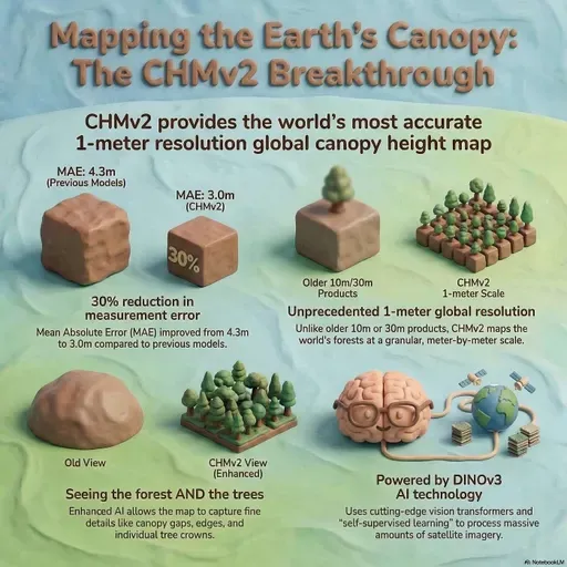
We explore how the World Resources Institute and Meta built CHMV2, a global canopy height map at 1-meter resolution. Using a self-supervised AI that predicts 3D depth from 2D satellite imagery, anchored by independent tree detection and aligned with airborne laser scans, this project overcomes seasonal and platform misalignment to reveal fine-scale forest structure and empower restoration, agroforestry, and biodiversity efforts.
Note: This podcast was AI-generated, and sometimes AI can make mistakes. Please double-check any critical information.
Sponsored by Embersilk LLC